")
")
")
")
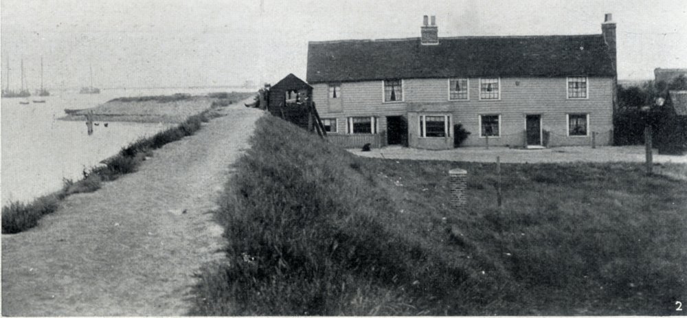
In the year 1622, one-third of the lands of Canvey Island was given in fee simple to Joas Croppenburgh, a Dutchman, in consideration of his securing the island from the overflowing of the tide and the encroachment of the sea. He accordingly built dykes on the Dutch principle. These remain to this day. In the island there is now no Dutch community.
Many thanks to sleekburn on ebay for sending me the page with these pictures and text.


Comments about this page
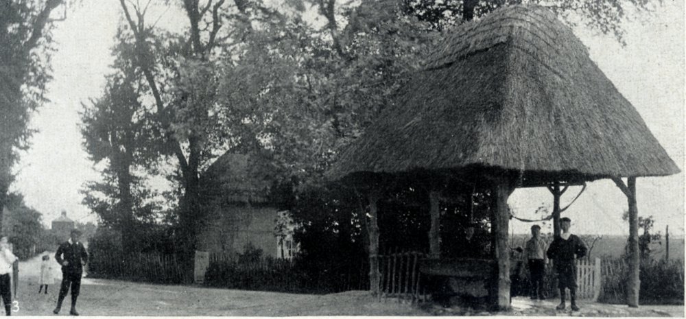
QUESTION : In the picture of “The Old Well”, on the left hand side of the picture by the child in dark clothes, down Haven Rd is a property, a large property with a chimney.
Can anyone identify this property?
I know there was a property on Haven road to the entrance of Brick House Farm ( to the right hand side of the farm entrance). I wonder whether it was that.
It was the vicarage Martin
I could see why you would say it is the vicarage, although I thought it might be a little to the left, off the image, and I am trying to “prove” if it could be.
I could be wrong of course but assuming :
The Vicarage was about 200ft from the camera position
The width of the first floor was 26ft
The property fits in the image about 30 times
Using trigonometry, with those assumptions above, assuming my maths is correct, it is impossible to be as close as the vicarage.
But there wasn’t any other houses down there. Brickhouse farm cottages were further down and set back at right angles to the road and were single story.
I could be mistaken but if you look at your map on:
https://www.canveyisland.org/places-3/places-2-3/the-village/old_canvey_maps , the one labelled “Canvey Village 1867”
you will see a property on the right hand side of the road that leads to Brick House farm but facing Haven road.
I wonder if this is a more likely candidate for the property?
If you look at the map dated 1898 no such building is there. https://www.canveyisland.org/places-3/maps/19th-century-maps/canvey-map-1898-edited-1923
Ok, so you are saying that the property was gone by 1923.
Looking in to this, it looks like they must have been pulled down in 1920 when the property and land changed hands from Kynoch to Swift.
Depends if it was on the original 1898 map. It could have just been a barn. Not showing up on any of the other maps I have looked at so far. We may never know Martin.
Add a comment about this page